-

Pörtschach am Wörthersee Dort, wo der See am schönsten ist
Panorama Trail Southern Alps: Stage 12 from Gasthof Rogar to Alpengasthof Riepl
-
Panoramaweg Südkärnten Stage 12
From Rogar Inn, the route leads to Potocnik Cave (Potocka Zijalka). On the ascent, you are accompanied by the backdrop of the little church of St. Duh and the sweeping view of the Logar Valley. A highlight of the stage is certainly the Potocnik Cave, which served as a dwelling for the Cro-Magnon people in the Ice Age. Skeletons of cave bears, weapons and tools made of stone and fireplaces prove that the cave was inhabited around 30,000 years ago. From the cave, it is a good half an hour's steep climb, which is rewarded with a fabulous panoramic view of the Uschowa. A strenuous stage but certainly one of the most beautiful sections of the Southern Alps Panorama Trail.
Attention: Please do not forget your travel document, as you will also be hiking on the Slovenian side.
Hike carefree on the Southern Alps Panorama Trail!
The Official Panorama Trail Southern Alps Info & Booking Center with the award-winning Trail Angels team will be happy to assist you. Whether you are an advanced hiker, a beginner or a climate-friendly hiker traveling by train: Hikers are in good hands with the competent and helpful booking center team. Especially if you want to combine personal freedom and a longing for something special with service, comfort and safety on your hike.
Information and booking:
Official Panorama Trail Southern Alps Info & Booking Center
Powered by Trail Angels
Obervellach 15, 9821 Obervellach
+43 4782 93093
www.trail-angels.com
https://www.bookyourtrail.com/trail/panoramaweg-suedalpenwww.trail-angels.com/service-offizielles-buchungscenter
Ascent: 951 m
Descent: 965 m
Minimum Altitude: 1198 m
Maximum Altitude: 1906 m
Length: 17.9 km
Duration: 285 min
Difficulty: hard
Condition:
Experience:
Landscape:
Author: KSL/Graßler

Directions:
On S highway/E66 - exit Griffen - Lippitzbacher Landesstraße - Mittlerner Landesstraße - Bleiburg state border - Poljana - Mezica - Gh Rogar
Public transportaion:
No public connection.
Parking:
Parking at the Rogar Inn.
Directions
From the Rogar Inn, the trail leads steadily uphill through the forest along the green-white-red circular markings towards Potocnik Cave (Potocka Zijalka). The cave is called Olseva or Obel kamen in Slovenian. During the ascent, you are accompanied by the backdrop of the Sveti duh church and the sweeping view of the Logar valley.
After about an hour, you reach the cave that served as a dwelling for the Cro-Magnon people during the Ice Age. Skeletons of cave bears, weapons and tools made of stone and fireplaces prove that the cave was inhabited around 30,000 years ago.
From the cave, it is a good half an hour's steep climb, which is rewarded with a fabulous panoramic view of the Uschowa. The second summit (Govca 1930 m) on the Slovenian side is easily accessible via a narrow path. The path leads exposed in a south-easterly direction over an unsecured rock step. The path reaches a fork. Keeping to the left, the trail quickly descends over scree fields and mountain pines.
Continue along a forest path and after a short time you will reach the Govseva Planina mountain pasture. The next section takes the hiker through a forest with old conifers. Then continue along a forest path. From here, it takes about one and a half hours to reach the Kumer Inn. From Gasthof Kumer, the forest road continues to the old border crossing. You then reach the extensive Luschaalm on the Carinthian side. In the last section of the trail, you pass the Friedenskirche church and continue along a paved road to Gasthof Riepl.
Höhenprofil

Do you want to allow Integration of external maps material?
Allows displaying map-material (images) from openstreetmap to provide interactive map-features. By allowing this feature, you accept the privacy agreement of openstreetmap.
Impressionen
Additional information
www.carnica-rosental.at
www.klopeinersee.at
www.region-lavanttal.at
Safety instructions
10 recommendations from the ÖAV
As an outdoor sport, mountain hiking offers great opportunities for health, community and adventure. The following recommendations from the alpine associations are designed to make mountain hikes as safe and enjoyable as possible.
1. healthy in the mountains
Mountain hiking is an endurance sport. The positive stress stimuli for the heart and circulation require good health and a realistic self-assessment. Avoid time pressure and choose a pace that ensures no one in the group gets out of breath.
2. careful planning
Hiking maps, guide books, the Internet and experts provide information about the length, altitude difference, difficulty and current conditions. Always adapt tours to the group! Pay particular attention to the weather forecast, as rain, wind and cold increase the risk of accidents.
3. complete equipment
Adapt your equipment to your tour and make sure your rucksack is light. Rain, cold and sun protection should always be in your backpack, as well as a first aid kit and cell phone (Euro emergency number 112). A map or GPS will help you find your way.
4. suitable footwear
Good hiking boots protect and relieve your feet and improve your sure-footedness! When making your choice, look for a perfect fit, non-slip tread sole, waterproofness and low weight.
5. sure-footedness is the key
Falls as a result of slipping or tripping are the most common cause of accidents! Be aware that too much speed or tiredness can severely impair your surefootedness and concentration. Watch out for falling rocks: by walking carefully, you can avoid falling rocks.
6. stay on marked trails
In pathless terrain, the risk of losing your bearings, falling and falling rocks increases. Avoid shortcuts and return to the last known point if you lose your way. Often underestimated and very dangerous: steep old snowfields!
7. take regular breaks
Taking a break at the right time helps you to relax, enjoy the scenery and socialize. Eating and drinking are necessary to maintain performance and concentration. Isotonic drinks are ideal thirst quenchers. Muesli bars, dried fruit and cookies satisfy hunger on the way.
8. responsibility for children
Make sure that variety and playful discovery are at the forefront for children! In passages where there is a risk of falling, one adult can only supervise one child. Very exposed tours that require prolonged concentration are not suitable for children.
9. small groups
Small groups ensure flexibility and allow for mutual help. Inform familiar people about the destination, route and return. Stay together in the group. Beware of lone hikers: even minor incidents can lead to serious emergencies.
10 Respect for nature and the environment
To protect mountain nature: do not leave any waste behind, avoid noise, stay on the paths, do not disturb wild and grazing animals, leave plants untouched and respect protected areas. Use public transport or form car pools to get there.
Equipment
Packing list - multi-day hike
Breathable hard shell jacket Fleece or softshell jacket Hiking pants, zip-off Hiking boots Backpack (approx. 35 liters) Functional T-shirts Functional underpants Pair of hiking socks Sun hat Rain trousers Thin hat and gloves Maps & tour description Water bottle or hydration bladder Hut sleeping bag/silk inlet Trekking poles GPS device LED headlamp Cell phone & alpine emergency number Sunglasses First aid kit Blister plaster Small pocket knife Sun cream Hygiene articles Travel towel Tour provisionsTips
Plan a little more time for this tour, as it is worth taking longer to admire and enjoy some of the highlights of this stage.
Literature
Compass - Panorama Trail Southern Alps No. 218
Maybe interesting
-
Winter hike Singerberg - read more
Winter hike Singerberg
-
Walk from Krumpendorf to Europapark - read more
Walk from Krumpendorf to Europapark
-
Julius Kugy three-country trail in 30 stages - E 3 - read more
Julius Kugy three-country trail in 30 stages - E 3
-
Julius Kugy three-country trail in 30 stages - E 2 - read more
Julius Kugy three-country trail in 30 stages - E 2
-
Water experience trail Hainschgraben - read more
Water experience trail Hainschgraben
-
Family hiking route "The Forest Lives" - read more
Family hiking route "The Forest Lives"
-
Zollfeld - read more
Zollfeld
-
Ironman route - 2011 - read more
Ironman route - 2011

Book and discover accommodation
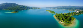
VisitPörtschach on Lake Wörthersee